


Page 319 - New Medley 5 Semester 1
P. 319
Mercator and Hondt were the first to publish a collection of maps in the form

        of a book in ad 1636. Its cover had a picture of the Greek mythological hero,
        Atlas, holding the Earth. Since then, a book of maps is called an atlas.


        Language of Maps

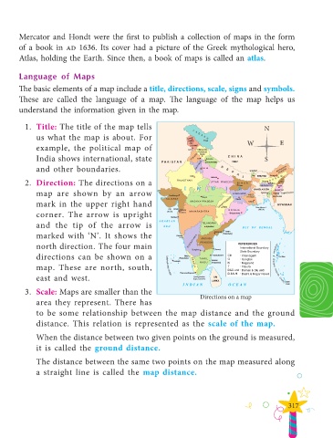
        The basic elements of a map include a title, directions, scale, signs and symbols.
        These are called the language of a map. The language of the map helps us

        understand the information given in the map.


          1.  Title: The title of the map tells                                                      N
               us what the map is about. For                                                               E

               example, the political map of                                                   W
               India shows international, state                                                      S

               and other boundaries.

          2.  Direction: The directions on a
               map are shown by an arrow

               mark in the upper right hand
               corner. The arrow is upright

               and the tip of the arrow is
               marked with ‘N’. It shows the

               north direction. The four main
               directions can be shown on a

               map. These are north, south,
               east and west.


          3.  Scale: Maps are smaller than the                               Directions on a map
               area they represent. There has

               to be some relationship between the map distance and the ground
               distance. This relation is represented as the  scale of the map.

               When the distance between two given points on the ground is measured,

               it is called the  ground distance.

               The distance between the same two points on the map measured along
               a straight line is called the  map distance.


                                                                                                              317

