


Page 288 - New Medley 4 Semester 1
P. 288
The Northern Plains of India can be divided into three sections or three

               river basins. These are:


               �  the Satluj River Basin                                        �  the Ganga River Basin

               �    the Brahmaputra River Basin

               The Satluj River Basin

               The western part of the Northern Plains
               of India is called the Satluj River Basin.

               It is drained by the Satluj river and its
               main tributary, the Beas. A major part of

               the Satluj River Basin lies in Punjab and
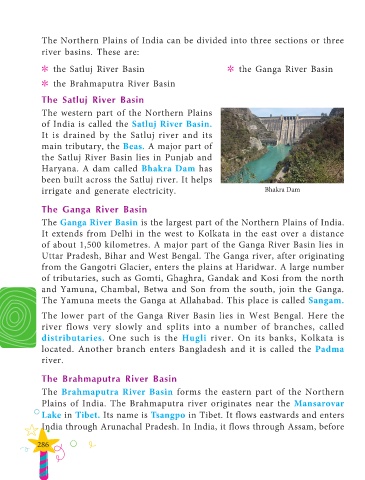
               Haryana. A dam called Bhakra Dam has
               been built across the Satluj river. It helps

               irrigate and generate electricity.                                           Bhakra Dam


               The Ganga River Basin

               The Ganga River Basin is the largest part of the Northern Plains of India.
               It extends from Delhi in the west to Kolkata in the east over a distance
               of about 1,500 kilometres. A major part of the Ganga River Basin lies in

               Uttar Pradesh, Bihar and West Bengal. The Ganga river, after originating
               from the Gangotri Glacier, enters the plains at Haridwar. A large number

               of tributaries, such as Gomti, Ghaghra, Gandak and Kosi from the north
               and Yamuna, Chambal, Betwa and Son from the south, join the Ganga.
               The Yamuna meets the Ganga at Allahabad. This place is called Sangam.


               The lower part of the Ganga River Basin lies in West Bengal. Here the
               river flows very slowly and splits into a number of branches, called

               distributaries.  One such is the  Hugli river. On its banks, Kolkata is
               located. Another branch enters Bangladesh and it is called the  Padma
               river.


               The Brahmaputra River Basin

               The  Brahmaputra River Basin forms the eastern part of the Northern

               Plains of India. The  Brahmaputra river originates near the  Mansarovar
               Lake in Tibet. Its name is Tsangpo in Tibet. It flows eastwards and enters

               India through Arunachal Pradesh. In India, it flows through Assam, before


              286

