


Page 347 - New Medley 5 Semester 1
P. 347
Physical Features

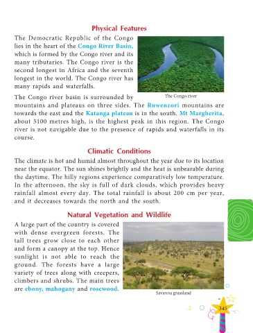
        The Democratic Republic of the Congo

        lies in the heart of the Congo River Basin,

        which is formed by the Congo river and its
        many tributaries. The Congo river is the
        second longest in Africa and the seventh

        longest in the world. The Congo river has

        many rapids and waterfalls.

        The Congo river basin is surrounded by                                     The Congo river
        mountains and plateaus on three sides. The  Ruwenzori mountains are

        towards the east and the Katanga plateau is in the south. Mt Margherita,
        about 5100 metres high, is the highest peak in this region. The Congo

        river is not navigable due to the presence of rapids and waterfalls in its
        course.


                                             Climatic Conditions

        The climate is hot and humid almost throughout the year due to its location
        near the equator. The sun shines brightly and the heat is unbearable during

        the daytime. The hilly regions experience comparatively low temperature.
        In the afternoon, the sky is full of dark clouds, which provides heavy

        rainfall almost every day. The total rainfall is about 200 cm per year,
        and it decreases towards the north and the south.


                                   Natural Vegetation and Wildlife

        A large part of the country is covered

        with dense evergreen forests. The
        tall trees grow close to each other

        and form a canopy at the top. Hence
        sunlight is not able to reach the

        ground. The forests have a large
        variety of trees along with creepers,

        climbers and shrubs. The main trees
        are ebony, mahogany and rosewood.
                                                                               Savanna grassland


                                                                                                              345

