


Page 277 - New Medley 4 Semester 1
P. 277
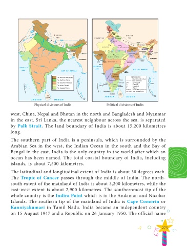
Physical divisions of India                      Political divisions of India


        west, China, Nepal and Bhutan in the north and Bangladesh and Myanmar
        in the east. Sri Lanka, the nearest neighbour across the sea, is separated

        by  Palk Strait.  The  land  boundary of  India  is  about  15,200  kilometres
        long.


        The southern part of India is a peninsula, which is surrounded by the
        Arabian Sea in the west, the Indian Ocean in the south and the Bay of
        Bengal in the east. India is the only country in the world after which an

        ocean has been named. The total coastal boundary of India, including

        islands, is about 7,500 kilometres.

        The latitudinal and longitudinal extent of India is about 30 degrees each.
        The  Tropic of Cancer passes through  the middle  of  India.  The  north-

        south extent of the mainland of India is about 3,200 kilometres, while the
        east-west extent is about 2,900 kilometres. The southernmost tip of the

        whole country is the Indira Point which is in the Andaman and Nicobar
        Islands. The southern tip of the mainland of India is  Cape Comorin or

        Kanniyakumari in Tamil Nadu. India became an independent country
        on 15 August 1947 and a Republic on 26 January 1950. The official name


                                                                                                              275

