


Page 299 - New Medley 4 Semester 1
P. 299
The Central Highlands

        The area towards the north of the Narmada is called the Central Highlands.

        It is bound by Aravalli range in the north-west, the Vindhya range in the

        south and Bundelkhand in the east. In the east, the Central Highlands
        extend up to the  Chhotanagpur Plateau in Jharkhand and Odisha. The
        Malwa Plateau lies between the Aravalli range and the Vindhya range.

        The Satpura range lies between the Narmada and the Tapi. These rivers

        flow towards the west and fall into the Arabian Sea. Rivers Chambal,
        Betwa and Son, join the Yamuna and the Ganga rivers.

        The black soil in the Central Highlands is very fertile. It is good for

        growing wheat, gram, oilseeds and cotton. The Chhotanagpur plateau
        region is rich in minerals, such as iron, mica, manganese, bauxite and

        coal. Many parts of the Central Highlands are covered with valuable
        dense forests.


                                            The Deccan Plateau

        The area which is towards the south of
        the Narmada river is called the  Deccan

        Plateau. This region extends from the
        Central Highlands in the north up to

        the southern tip of the Indian peninsula.
        It is  surrounded by  the hill ranges all

        sides. Towards the west is the continuous
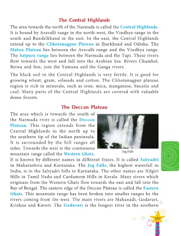
        mountain range called the Western Ghats.                                       Jog Falls
        It is known by different names in different States. It is called  Sahyadri

        in Maharashtra and Karnataka. The  Jog Falls, the highest waterfall in

        India, is in the Sahyadri hills in Karnataka. The other names are Nilgiri
        Hills in Tamil Nadu and Cardamom Hills in Kerala. Many rivers which

        originate from the Western Ghats flow towards the east and fall into the
        Bay of Bengal. The eastern edge of the Deccan Plateau is called the Eastern

        Ghats. This mountain range has been broken into smaller ranges by the
        rivers coming from the west. The main rivers are Mahanadi, Godavari,

        Krishna and Kaveri. The  Godavari is the longest river in the southern


                                                                                                              297

